Actionable Satellite Data,
Zero Complexity.
Raw satellite images don’t solve business problems. We turn them into clear insights that drive outcomes.
From Raw Data to Ready Intelligence.
Pipelines, verification, analytics, and real-time alerts; Everything you need to turn satellite data into business outcomes.
We provide cleaned and sanitized satellite data pipelines, accessible through simple APIs or direct firehose connections for seamless integration.
Intelligent Satellite Data
From enhancing image quality and clearing cloud cover to delivering ready-to-use analytics, we make satellite intelligence accessible and affordable.
Resolution Enhancement
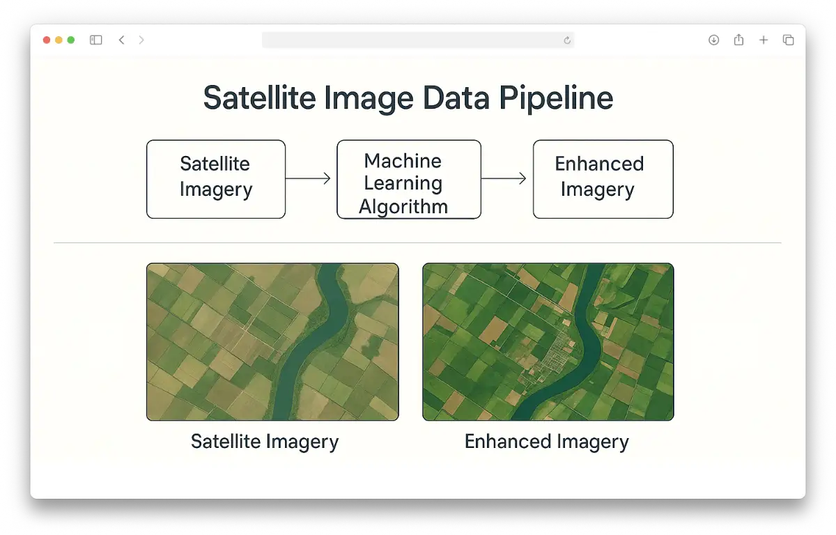
Enhanced Data, 70% Lower Cost.
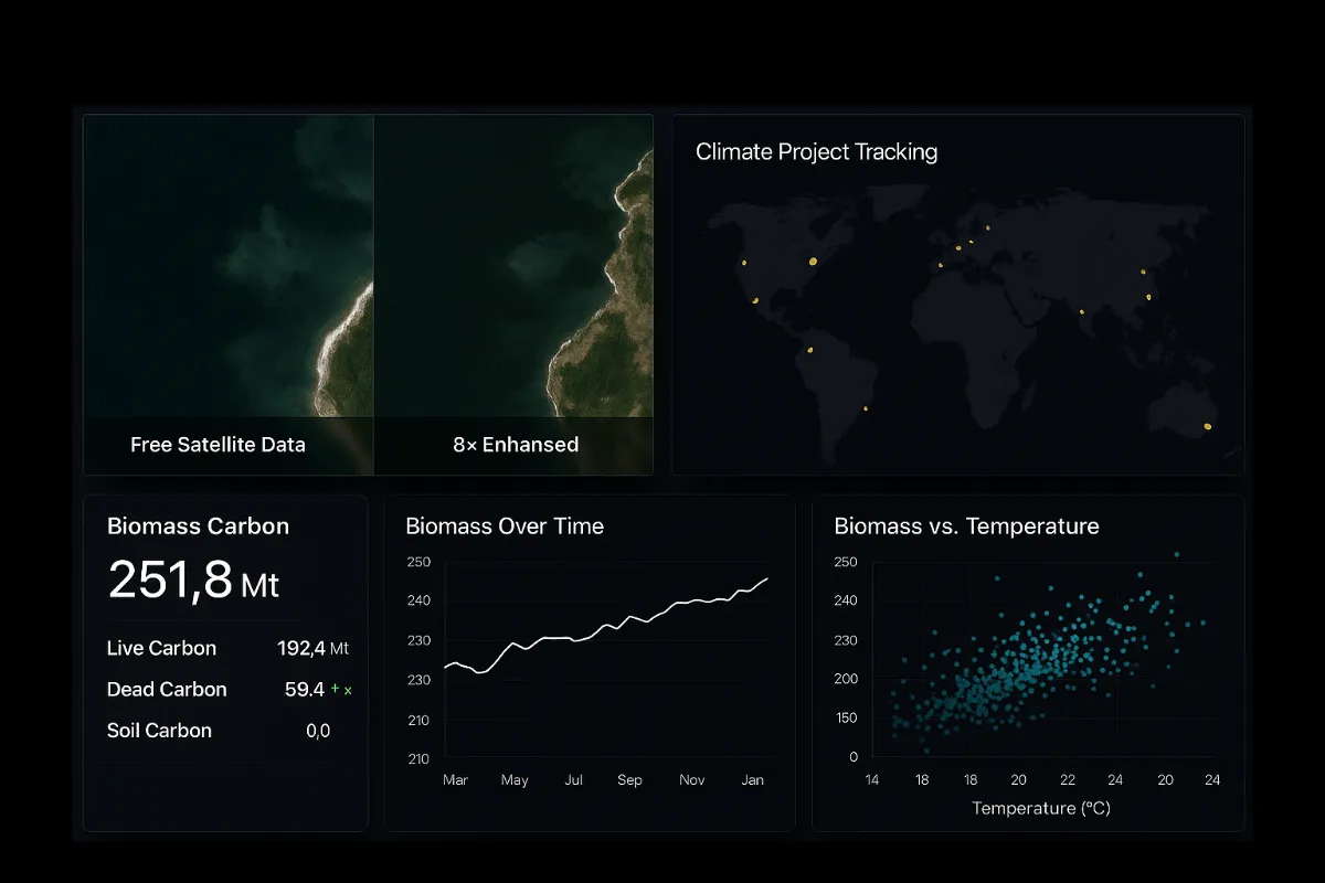
Our proprietary machine learning algorithm enhances any satellite image up to 8-times, delivering sharper detail than raw imagery. This reduces acquisition costs by at least 70%, without sacrificing quality.
Cloud-Cover Removal
90% Clarity, Rain Or Shine.
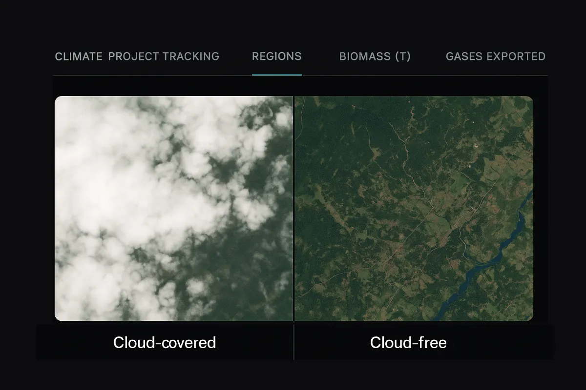
We achieve up to 90% clarity in cloud-covered imagery, compared to the industry standard of less than 35%. This ensures reliable visibility for critical decisions, even in challenging weather conditions.
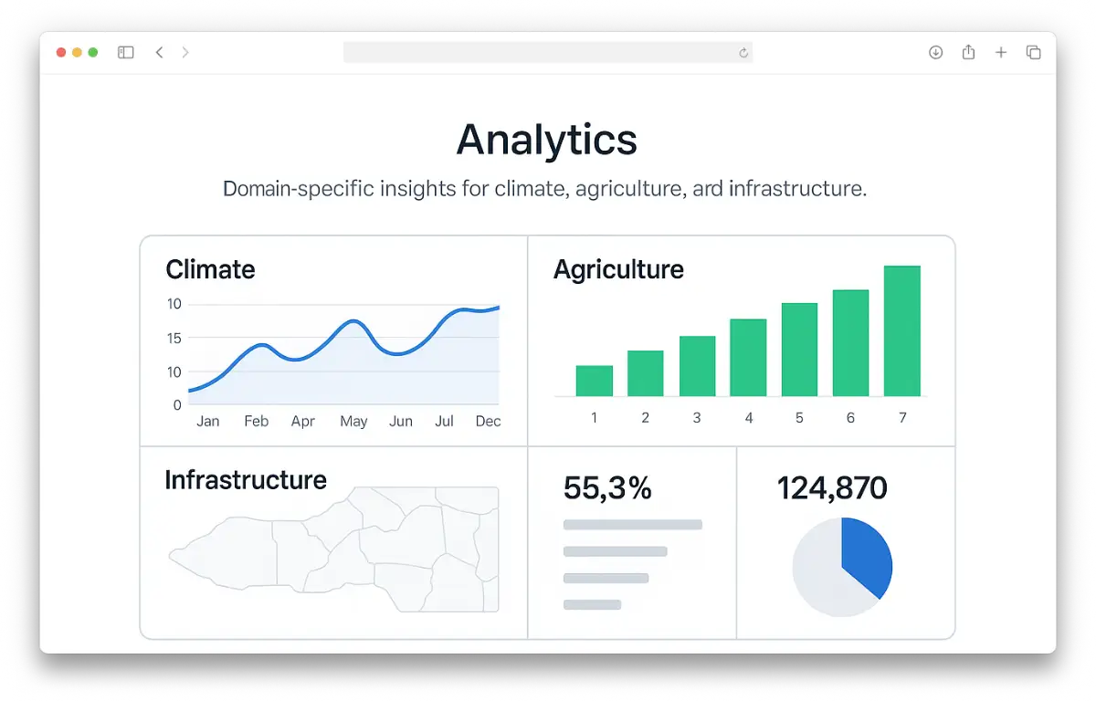
Domain-Specific Analytics
Instant Insights, No Experts Needed.
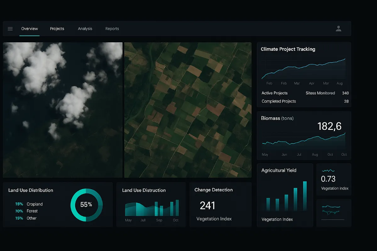
Our platform converts complex satellite data into ready-to-use insights for industries like agriculture, infrastructure, and energy. Businesses get actionable intelligence without needing in-house geospatial expertise.
Enhanced Data, 70% Lower Cost.
Our proprietary machine learning algorithm enhances any satellite image up to 8-times, delivering sharper detail than raw imagery. This reduces acquisition costs by at least 70%, without sacrificing quality.
90% Clarity, Rain Or Shine.
We achieve up to 90% clarity in cloud-covered imagery, compared to the industry standard of less than 35%. This ensures reliable visibility for critical decisions, even in challenging weather conditions.
Instant Insights, No Experts Needed.
Our platform converts complex satellite data into ready-to-use insights for industries like agriculture, infrastructure, and energy. Businesses get actionable intelligence without needing in-house geospatial expertise.
FAQs
What makes your satellite data different from others?
We enhance imagery up to 8× using proprietary machine learning, reduce cloud cover to 90% clarity, and deliver ready-to-use analytics.
Do I need geospatial expertise to use your platform?
No. Our tools are designed for easy consumption via APIs, dashboards, and automated analytics, so no in-house expertise is required.
How does your cloud-cover removal work?
Our algorithms clear up to 90% of cloud obstruction, far surpassing the industry standard of ~35%, ensuring reliable imagery in all weather conditions.
Can you integrate with our existing systems?
Yes. We provide cleaned and sanitized data pipelines, accessible via simple APIs or direct firehose connections for seamless integration.
Which industries benefit most from your solutions?
We serve climate projects, agriculture, infrastructure, energy, and disaster response—anywhere accurate satellite insights drive better outcomes.
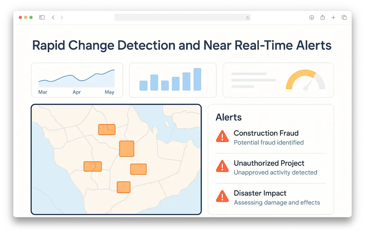
How real-time are your alerts?
Our system delivers industry-specific change detection and alerts within hours, enabling rapid responses to construction, compliance, or disaster events.
Do you provide analytics or just raw satellite data?
Both. We can supply raw imagery if needed, but our strength lies in delivering domain-specific analytics tailored to your business needs.
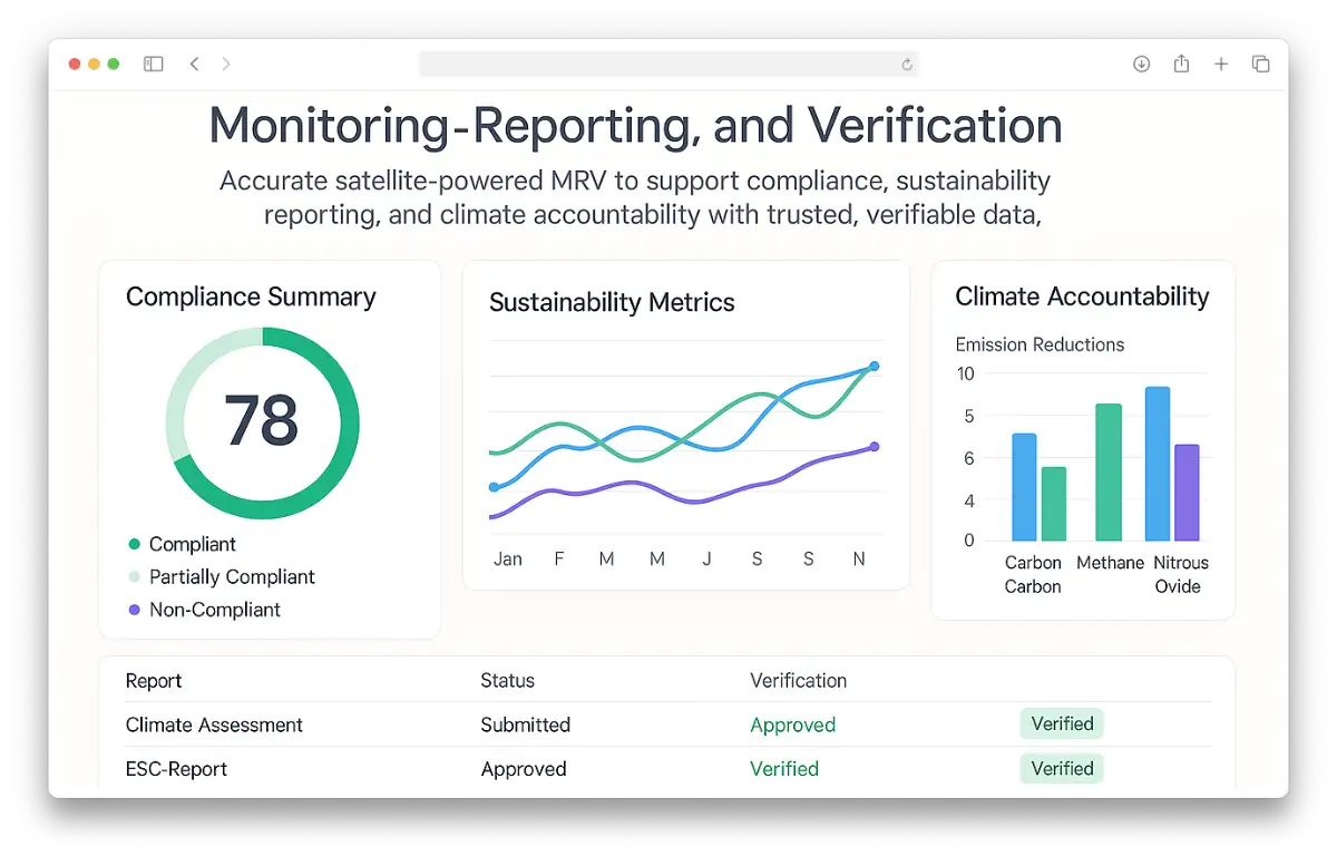
How do you support Monitoring, Reporting, and Verification (MRV)?
We provide satellite-based MRV tools that ensure accuracy and transparency for compliance, sustainability goals, and climate accountability.
What regions or geographies can you cover?
Our solutions are global, leveraging multiple satellite sources to provide comprehensive coverage across regions and industries.